Greece. Kephallénia
THE PROJECT
Under the auspecies of the Sixth Ephorate for Antiquities at Patras an archaeological investigation of the landscapes and sites of the large tracts of north ern, central, eastern, and south-eastern Kephallénia (Same, Pronnoi, etc.) was carried out during the early to mid-1990s by the Archaeological department, University of Copenhagen.

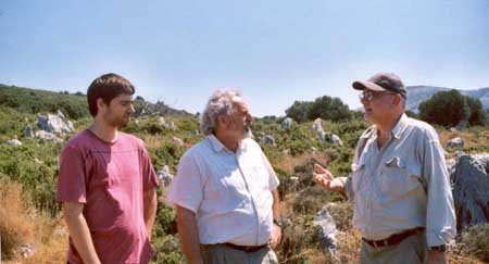
Prof. Klavs Randsborg with Mr. Makis Metaxa, President of the township of Poros and archaeology student Dionysios Metaxa at Krane.
The community of Poros is deeply interested in it's past and gives an extraordinary support to archaeological-historical research on the island.
This work, directed by prof. Klavs Randsborg, also involved the recording and mapping of ancient Greek walls and other structures in stone. Comprehensive studies, particularly of walls and planned cities, in other parts of Greece , and even beyond, were also made in this connection.

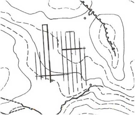
General plan of the never built planned city at Krane ("Nea Krane"), as well as the old city in the South
Common methodology stresses the necessity of highly detailed cross-country surveys (usually in limited areas only). The Kephallenian operation, however, has been a conscious mixture of intensive and extensive work (across whole regions). Aided by detailed artefact studies, this undertaking has provided an overall picture of the archaeology of all periods across a very large area indeed and thus enabled an historical approach to the development. By contrast, the pioneer mapping and detailed typological-chronological study of the ancient Greek walls, in reality stone by stone, has been highly detailed.
 |
|
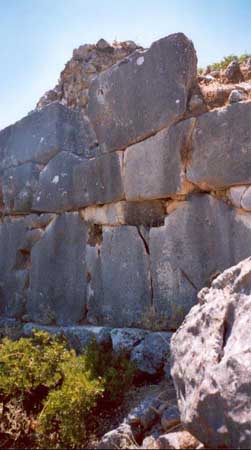
Same acropolis, wall type 17. One of the project objectives has been to classify and date ancient Greek wall. Detailed research have revealed that typological and technical analyses of the walls do provide an considerable dating tool. Thus 27 types of walls have been distinguished on the island.
|
The archaeological surveys have revealed a total of more than five hundred settlement sites, usually representing several of the main chronological phases from the Palaeolithic to cl5OO AD, and even later. (The cities comprise several settlement units.) This number of settlement sites and components, however high, is doubtless but only a sample of the original number.
 |
|
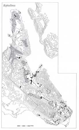
Map of the surveyed sites and units on northern, central, eastern and southern Kephallénia. Indications of the degree of work, ranging from intensive (black areas) to extensive surveys(shaded areas). |
|